World War 1 Historical Maps Clip Art
SKU:
£3.99
£3.99
per item
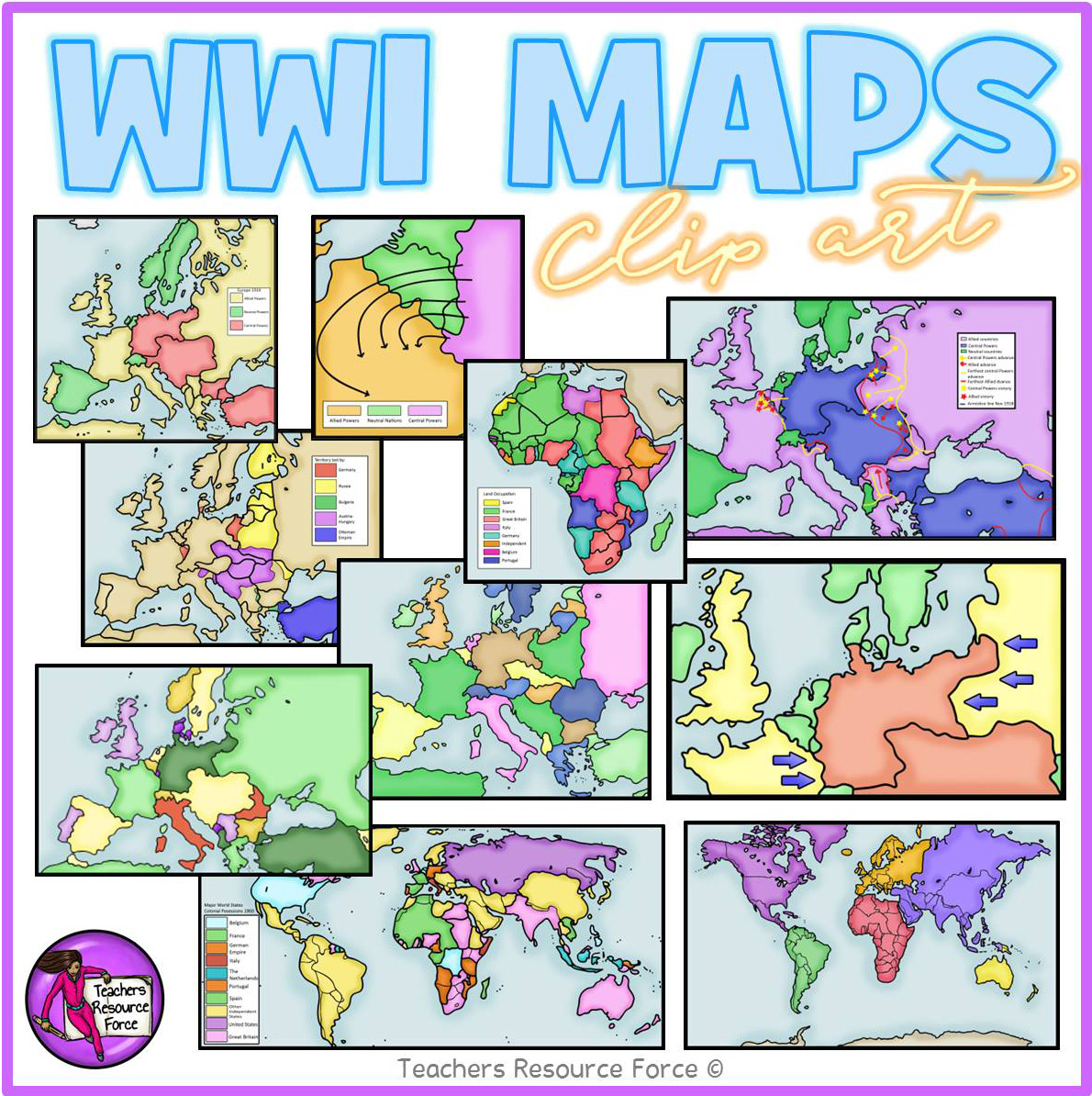
Get hold of this quality set of WW1 historical maps, perfect for your teaching resources and wall displays.
Product includes:
• Germany fighting 2 war fronts
• Post WW1 Europe and Middle East areas lost
• Post WW1 Europe and Middle East
• The Schlieffen Plan
• WW1 Africa 1914
• WW1 Allied and Central Powers 1914
• WW1 Colonial Powers 1914
• WW1 Europe and Middle East 1914
• WW1 Europe
• WW1 World at War
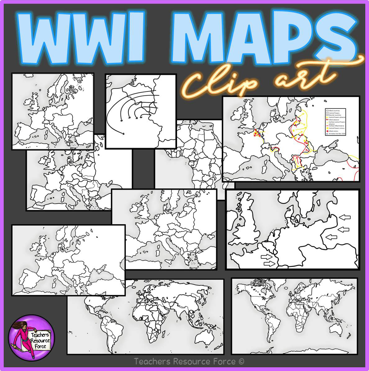
Each image is 300dpi png with transparent edges and closely cropped. Each map comes in colour as well as white and grey scale.
Product includes:
• Germany fighting 2 war fronts
• Post WW1 Europe and Middle East areas lost
• Post WW1 Europe and Middle East
• The Schlieffen Plan
• WW1 Africa 1914
• WW1 Allied and Central Powers 1914
• WW1 Colonial Powers 1914
• WW1 Europe and Middle East 1914
• WW1 Europe
• WW1 World at War
Each image is 300dpi png with transparent edges and closely cropped. Each map comes in colour as well as white and grey scale.